Leverage existing GIS data to reduce data entry time for staff and citizens.
Laserfiche to ArcGIS Integration Connector
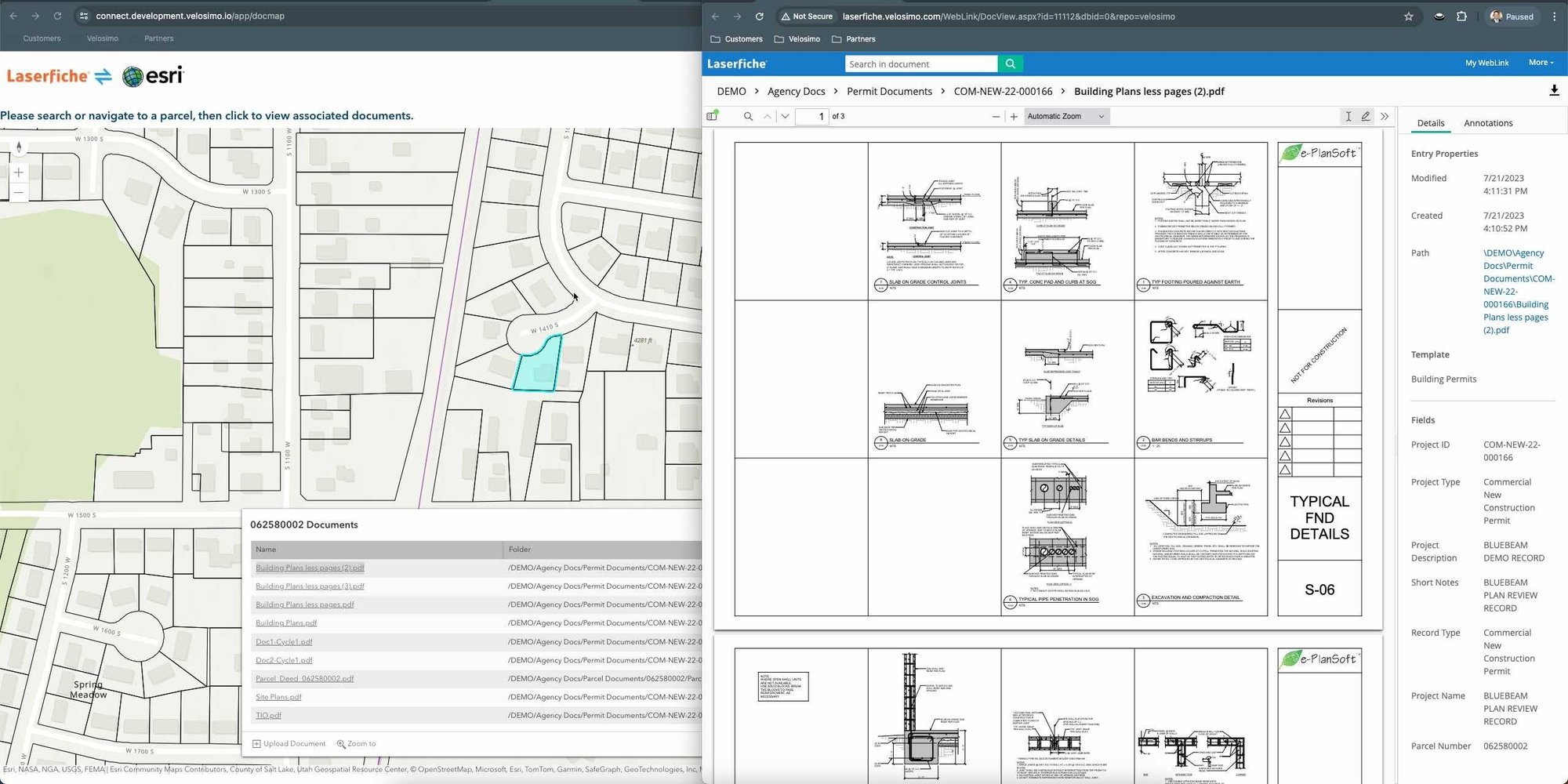
Experience the power of seamless automation with the Velosimo off-the-shelf integration for Laserfiche to ArcGIS connector. Empower your citizens and staff by automating data entry by pulling data from ArcGIS layers to auto-populate fields on Laserfiche forms or allow staff to browse for documents on maps with the GISDocs capability. With configurable settings, this versatile solution can be easily set up for any form, enabling your business processes to leverage existing GIS data for optimal efficiency.
GISDocs for Laserfiche
- Leverage agency map services in a viewer that displays Laserfiche documents based on location
- The GISDocs viewer can be configured to use any GIS layer and Laserfiche metadata combination to display documents by location
- Ability to view the documents in various Laserfiche folders based on metadata queries
- Documents can be viewed using the Laserfiche Weblink tool providing a document viewer for the documents located on the map
- Quick and easy setup and maintenance on the connector
Laserfiche Forms to ArcGIS Integration Connector
- Embed a map viewer into your existing Laserfiche forms
- Leverage ArcGIS spatial queries to retrieve data from multiple ArcGIS layers and auto-fill Laserfiche form fields
- Configurable settings that allow mapping ArcGIS Layer attributes to Laserfiche form fields
- Ability to execute data lookups to ArcGIS based off on entry into Laserfiche form fields
- Supports Laserfiche/ArcGIS On-Premise and Cloud via APIs
- Quick and easy setup and maintenance designed for business users
- Insight into transactions, smart recovery activities, and connected system outages


